KI-Beratung Beta

Produktbild: Landscape Ecology and Water Management

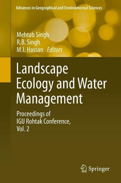
Landscape Ecology and Water Management Proceedings of IGU Rohtak Conference, Vol. 2

219,99 €

inkl. gesetzl. MwSt.

Beschreibung

The over-exploitation of important earth resources such as land and water has led to a number of environment-related problems the world over. At the same time, land-use change caused by various human activities has led to extinction of many plant and animal habitats and species. In this context, the...

Beschreibung

The over-exploitation of important earth resources such as land and water has led to a number of environment-related problems the world over. At the same time, land-use change caused by various human activities has led to extinction of many plant and animal habitats and species. In this context, the relevance of biodiversity for human survival is becoming a major international political issue as scientific evidence builds on the global health implications of biodiversity loss. These issues are closely linked with the issue of climate change, as many of the health risks due to climate change are associated with rapid degradation of biodiversity. This present work focuses on holistic natural resource-based spatio-temporal planning, development and management and considers them as essential to save the degraded ecosystem for sustainable resource management. Contributions are compiled in two volumes: 1. Climate Change and Biodiversity and 2. Landscape Ecology and Water Management. Geoinformatics along with its tools such as remote sensing and Geographical Information Systems (GIS) have been used in assessing the results of various environmental problems both physical and social. These volumes will be useful for geographers, geoscientists, hydrologists, landscape ecologists, environmentalists, engineers, planners and policy makers.

Produktdetails

Format

PDF

Kopierschutz

Nein

Family Sharing

Nein

Text-to-Speech

Nein

Produktdetails

Format

PDF

Format

eBooks im PDF-Format haben eine festgelegte Seitengröße und eignen sich daher nur bedingt zum Lesen auf einem tolino eReader oder Smartphone. Für den vollen Lesegenuss empfehlen wir Ihnen bei PDF-eBooks die Verwendung eines Tablets oder Computers.

Kopierschutz

Nein

Kopierschutz

Dieses eBook können Sie uneingeschränkt auf allen Geräten der tolino Familie, allen sonstigen eReadern und am PC lesen. Das eBook ist nicht kopiergeschützt und kann ein personalisiertes Wasserzeichen enthalten. Weitere Hinweise zum Lesen von eBooks mit einem personalisierten Wasserzeichen finden Sie unter Hilfe/Downloads.

Family Sharing

Nein

Family Sharing

Mit Family Sharing können Sie eBooks innerhalb Ihrer Familie (max. sechs Mitglieder im gleichen Haushalt) teilen. Sie entscheiden selbst, welches Buch Sie mit welchem Familienmitglied teilen möchten. Auch das parallele Lesen durch verschiedene Familienmitglieder ist durch Family Sharing möglich. Um eBooks zu teilen oder geteilt zu bekommen, muss jedes Familienmitglied ein Konto bei Thalia oder einem anderen tolino-Buchhändler haben. Weitere Informationen finden Sie unter Hilfe/Family-Sharing.

Text-to-Speech

Nein

Text-to-Speech

Bedeutet Ihnen Stimme mehr als Text? Mit der Funktion Text-to-Speech können Sie sich im tolino webReader und in der aktuellen Thalia – Lesen & Hören App das eBook vorlesen lassen. Weitere Informationen finden Sie unter Hilfe/Text-to-Speech.

Erscheinungsdatum

22.05.2014

Herausgeber
Verlag Springer Japan
Seitenzahl

352 (Printausgabe)

Dateigröße

13050 KB

Sprache

Englisch

EAN

9784431548713

Barrierefreiheit
  • keine Information zur Barrierefreiheit bekannt

Noch keine Bewertungen vorhanden

Verfassen Sie die erste Bewertung zu diesem Artikel

Helfen Sie anderen Kundinnen und Kunden durch Ihre Meinung.

Kundinnen und Kunden meinen

Bewertungen (0)

Weitere Artikel finden Sie in

  • Produktbild: Landscape Ecology and Water Management
  • Landscape Ecology.- Detection of Land Use Change and Future Prediction with Markov Chain Model in a part of Narmada River Basin, Madhya Pradesh.- Spatio-Temporal Change Of Crop Diversification In Kerala.- Modelling Of Dynamic Relationship Between Socio-Economic Changes And Deforestation In Kolasib District Of Mizoram.- Application of Remote Sensing and GIS for Landslide Disaster Management - A case from Abay Gorge, Gohatsion - Dejen Section, Ethiopia.- Implications of Land Use/Cover Dynamics to Land Degradation And Land Management In The Gerado Catchment, North Eastern Ethiopia.- Landslide Disaster Management and Reduction- An approach through Remote Sensing and GIS.- Mapping Horticultural Crops in Dabwali, Rania and Ellenabad Blocks of Sirsa District, Haryana, India.- Geospatial Approach to Cropping System Analysis A Block Level Case Study Of Hisar District In Haryana.- Dynamics of on-Farm Land Use Changes in terms of Inter-Specific Crop Diversity: A Case Study of Panipat District of Haryana State, India.- Application of AHP & GIS in identifying the Suitable Landfill Sites.- Population-Development-Environment Interface and Flood Risk in Murshidabad, West Bengal.- Population Characteristics and Distribution of Land Holdings in Cold Desert of Lahaul-Spiti District of Himachal Pradesh.- Cropping System Analysis Using Geo-Informatics Approach: A case Study of Panipat District, Haryana.- The study of Urban Form and Regional Development for National Capital Region.- Population Environment Interface In Urban India: A Geographical Analysis.- Direct Cash Transfer: Govt Approach and Grass Root Challenges - A case study of Una District, Himachal Pradesh Using Remote Sensing and GIS.- Urban Environmental Settings of Dharuhera, Haryana Using Remote Sensing.- Temporal Urban Pattern Assessment of Haryana by Geo-informatics Technology.- Soil erosion risk assessment and spatial mapping in Jhagrabaria watershed, Allahabad, U.P. (India) by using LANDSAT 7ETM+ remote sensing data, Revised Universal Soil Loss Equation (RUSLE) and Geographical Information System (GIS).- Qualitative Assessment of Bank Erosion Hazard In A Part of The Haora River, West Tripura District.- Spatio-Temporal Shift of Right Bank Of The Gumti River, Amarpur Town, Tripura And Its Impact.- Two Indices To Measure The Intensity Of Meander.- A Geospatial Analysis of Flood Risks and Vulnerability in Ogun-Osun River Basin, Nigeria.- Groundwater Vulnerable Zones In Perspective Of Agriculture: A case study of Haryana: 2001.- Integrated GIS & Remote sensing Approach For Delineation of Groundwater Recharge Zones - A Case Study of Tons Basin, Allahabad District, Uttar Pradesh, India.- Integrated Approach of Remote Sensing and Gis for Watershed Management: A Case Study of Wga-2a Sub-Watershed of Godavari River Basin, Nagpur, Maharashtra.- Evaluation of Drainage Morphometry in Thalisain Area of Lesser Himalaya.- Remote Sensing and GIS Approach for Hazard Vulnerability Assessment of Upper Alaknanda Basin, Garhwal Himalaya (Uttarakhand), India.